|
|
 |
|
 |
|
Reconnaissance-level Surveys of
Selected Reaches of the Gualala River
by Helicopter
During 2007, three helicopter over-flights of the Gualala River were undertaken along selected stream reaches. These three initial flights were designed to evaluate the feasibility of helicopter surveys for:
- Counting adult steelhead and their redds (spawning sites);
- Evaluating the extent of summertime dewatering of the stream; and
- Identifying significant stream perturbations linked to the dewatering or to other threats to the rivers steelhead population.
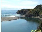
Gualala streams surveyed by helicopter during mid-to-late March (two surveys) and in September (one survey) 2007 included Rockpile Creek, House Creek, South Fork and Wheatfield Fork. For details of these surveys, refer to the 2007 Annual Report. Photographs from the surveys appear in the Photo Gallery.
The conclusion was that feasibility of helicopter surveys is high and thus, presently, a source of funding to continue them is being sought. If funding is secured, helicopter surveys will become part of this investigators standard survey protocol in 2008.
The three reconnaissance-level surveys were based on visual observations only. However, for long-term spawning surveysand especially for summertime surveys of the dewatering phenomenon photography (video or still photographs) will most likely play an important role. In particular, the utility of gyro-stabilized, TV-station-quality video will be tested and evaluated.
|
|
|
|
|